Showing posts with label New France. Show all posts

Wednesday, January 1, 2014

So, when did this take place?

Well, obviously during the American revolution, which was about 250  years ago. So it was a different time. You got around on a horse(if you were lucky), or walked:

and you made your food - that means you chopped the head off a chicken, or had your slaves do it for you (always hard to handle) And if you were in the wilderness, you had make sure Indians didn't kidnap you.
But technology was happening,  as witnessed by the old saw that the British were  defeated because they used muskets, wore those bright  red jacket, and stood in the open whereas the Rebels dressed in buckskin, used rifles, and always hid behind trees. While there is some truth to, but like most old truisms, there's more benath the surface. Witness Banastre Tarleton- a British General:
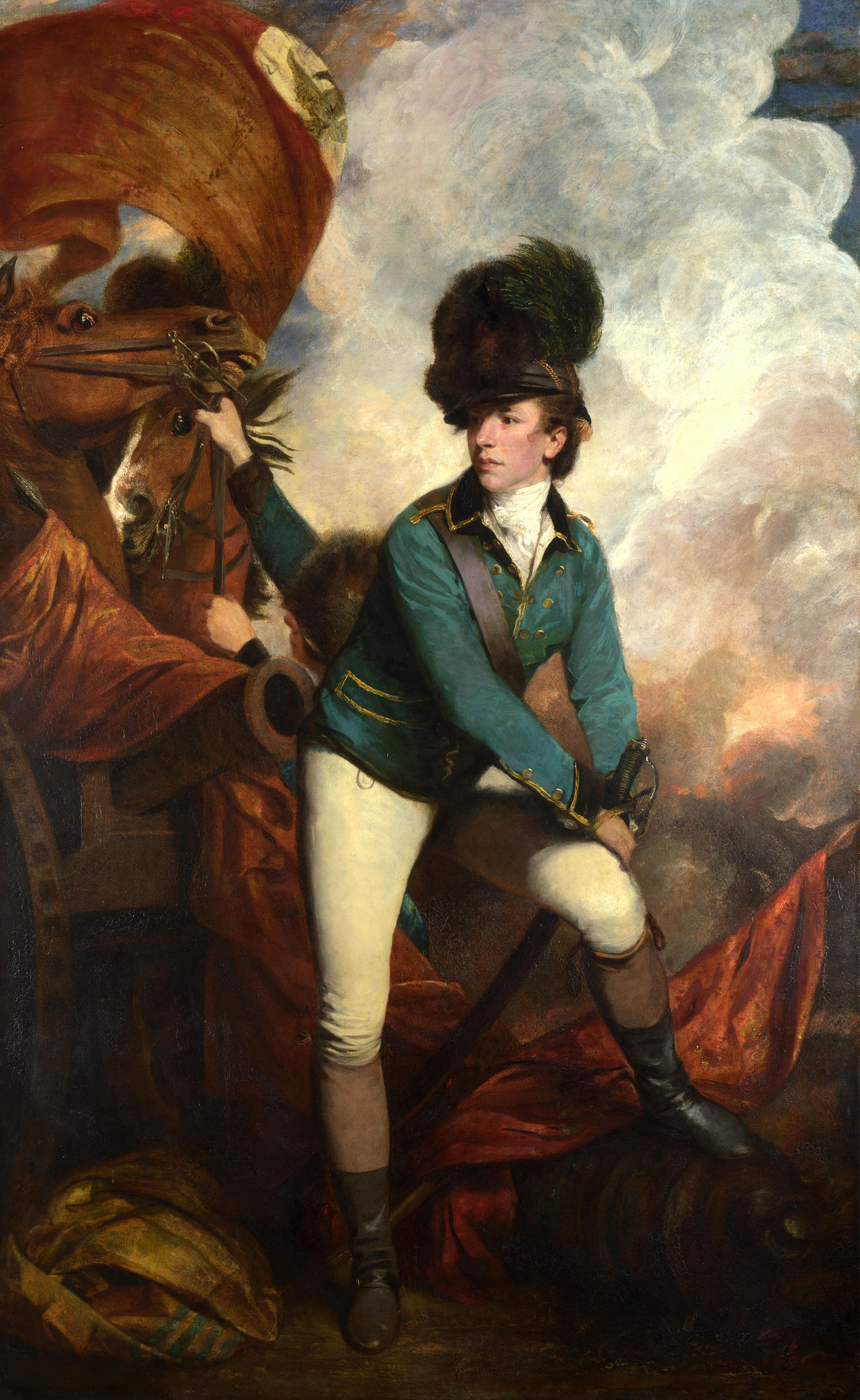
Not exactly a Red jacket, eh? And then there's Robert Rogers, along with the Ferguson Rifle And the most important battle of the war, that of Saratoga, was won by the Americans.
Similarly, The border lines between what became the United States and Canada were a little more fluid. Consider the lines at the start of The French and Indain wars, about twenty years before 1778:
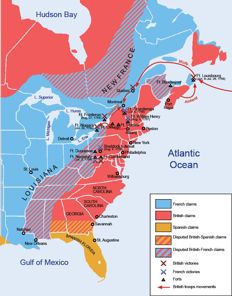

The British were limited mostly to the coast, although they were pushing inland, mainly from Virginia, Pennsylvania, and New York. While the land that became the Midwest changed from French to British or Spanish (depending on which side of the Mississippi you were on), the few European Settlement were French: Saint Louis, Sainte Genevieve, Detroit.
And the Settlers kept on pushing west, which made the Native Americans made. A conference was held at Fort Stanwix (modern day Rome, NY) and the line between White and Red men was codified thus:
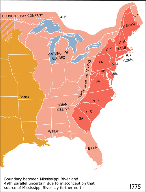

only as can guess, we americans  couldn't be bound by no dadgum lines. Not to mention they lines confliceted - New York and New Hampshire both claimed Vermont, and both New York and Virgina claimed the old northwest:  Ohio, Michigan, Indiana, Illinois, and Wisconsin.:

So  Colonel Clark was  acting partly to enforce a territorial claim. But more importantly, he wanted to protect the settlers who had made it over the mountains from the Indians , who were firmly in the British camp. He reckoned the best way to do this was to remove the British, and then deal with Indians, French, and Spanish fairly and honestly, What a concept, eh? Of course, how he did it is half the fun, and why i'm writing a novel on it.
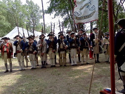
And that past isn't far behind us. All you have to do is go to a re-enactment event:

Thursday, October 31, 2013

Where is Vincennes?


So, how did a little town in Southern Indiana become a focal point in the American Revolution?

Water - it was a place where one could ford (wade across)the Wabash. A lot of population patterns then were predicated on rivers, since they were the Interstates of the day. Albany, where I'm at now, is at the junction of the Hudson and Mohawk rivers. Saint Louis is also situated near a river junction, that of the Mississippi and Missouri. The Indian's 'capital', Kekoinga (now Fort Wayne) is at a portage(Carry your canoe a few miles) between the Great Lakes and the Ohio River via the Wabash. If you know George's story, you know it also involves some more towns. Let's take a look at another: Kaskaskia, Illinois:

You probably notice several things odd about this map, like how there appears to be no town there, and that the line between Missouri and Illinois doesn't follow the Mississippi river. Well, therein lies the tale. Kaskaskia was another town started by the French at what was then a major junction, the meeting of the Kaskaskia and Mississippi rivers. You've probably noticed the current location is nowhere near the two rivers. That's because it used to be up where the green spot to the north of town is on the map. The Mississippi did run down the state line, and the town was used to shortcut of the Oxbow(big bend) 'Old Man River' made here. In the flood of 1844, the Mississippi changed its course, wiping out the town. The townsfolk relocated to present location until the flood of 1993 turned it into a Ghost town. All's that left of the former capital of Illinois is the Church(with Moi in front):

and the Bell, which Father Gibualt rang in 1778:

There was some reminders of yesterday, when Kaskaskia had a Big Street:

And the final town I'm going to talk about was called Corn Island. It goes by a different name now:
Louisville was the site of the Falls of the Ohio, a series of Rapids on the Ohio river. Once again, a natural junction and choke point. Colonel Clark built a fort here on an island. Like Kaskakia, the river moved, and now I-64 in downtown Louisville sits on Corn Island.

And the Falls? well, our friends from the Corps of Engineers got busy and built a Lock and dam over the falls to make the transit easier. Hope you enjoyed it, and see you next time. Jana